


.jpg)


Central Link Project final plans shift controversial new road further away from residents
Infrastructure Malta has submitted its final plans and the environment impact studies for the Central Link Project that will upgrade the stretch of road between the Mrieħel bypass and the foot of Saqqajja Hill

16 January 2019, 1:10pm
Kurt Sansone
Kurt Sansone
3 min read
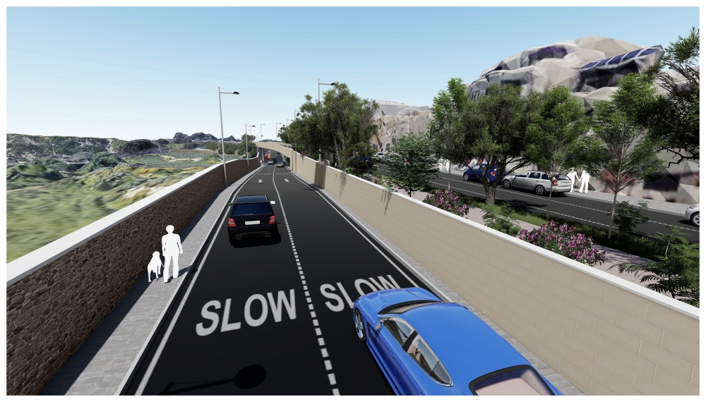
The north-bound lanes will be further away from residents and more than a storey below residential streets
A new north-bound road in the outskirts of Attard has been shifted further away from residences, according to the finalised plans for the Central Link Project.
Infrastructure Malta said the new road, which will carry the two north-bound lanes will be separated from the residential area by a wider landscaped area and a new four-metre segregated cycle track.
The new road will also be built more than one storey below the residential street level to “drastically reduce the visual impact on nearby houses and villas”, the agency said.
Residents had objected to this section of the proposed project because the new road would pass through agricultural land in front of a residential area. Controversy had also surrounded the number of trees that would be lost in the stretch of road leading up to the foot of the Saqqajja hill, although amended plans had drastically cut these losses.

The new plans include a 40-metre flyover to improve accessibility between Attard and the northbound carriageway
The new plans include a new 40-metre flyover to improve the accessibility and safety of the route from Attard to the northbound carriageway of Triq l-Imdina, towards Ta’ Qali.
Infrastructure Malta said the environmental impact assessment (EIA) of the Central Link Project has confirmed the latest proposal as the most effective and sustainable solution to reduce travelling times and improve air quality along the arterial road corridor between Mrieħel and Ta’ Qali.
The agency said that unless the roads are upgraded, this route will become completely gridlocked within 10 years, with serious air quality implications to nearby localities.
The EIA studies were submitted with the Environment and Resources Authority, while the final project plans were submitted with the Planning Authority.
“The EIA will soon be published by the authorities as part of the final consultations before the development application is determined. The project plans were updated following extensive consultations with the area’s residents, non-governmental organisations and other entities,” Infrastructure Malta said.
According to the agency, the EIA confirmed that the Central Link Project plans will require 57% less agricultural land than the amount originally earmarked in a similar road upgrade proposal planned 13 years ago.
The 2006 plans, which were never implemented, had already indicated congestion along Triq l-Imdina, Triq in-Nutar Zarb and other nearby roads as a major problem for Attard and nearby localities.
Infrastructure Malta said the air quality study showed that if the project was not implemented, particulate matter (PM10) and nitrogen dioxide (NO2) emissions from traffic in the area, would increase by 104% and 35% in 2030 and get progressively worse.
“By eliminating existing bottlenecks and congested junctions, Central Link Project will lead to average PM10 reductions of 42% by 2030 and 60% by 2045, even when considering future transport demand. NO2 emissions will be lowered by 15% in 2030 and 30% in 2045,” Infrastructure Malta said.
What is the Central Link Project?
- The project targets the arterial road extending from the Mrieħel Bypass to the roundabout at the foot of Saqqajja Hill.
- The project will create a four-lane road along this route, reconstruct 13 junctions, remove four traffic lights and smooth access to and from this road to the residential areas
- The project will add over seven kilometres of new lanes along a 4.3 kilometre road corridor.
- It will also include pedestrian footpaths and what is being billed as the longest segregated cycle track in Malta.

Kurt Sansone is Executive Editor of MaltaToday.
He was formerly deputy editor of MaltaTod...