.png)


Autumn the wettest on record since 1999
Until November, Malta already received 83% of the total rainfall expected during the precipitation year, which starts in September and ends in August

3 December 2021, 7:17pm
Karl Azzopardi
Karl Azzopardi
1 min read
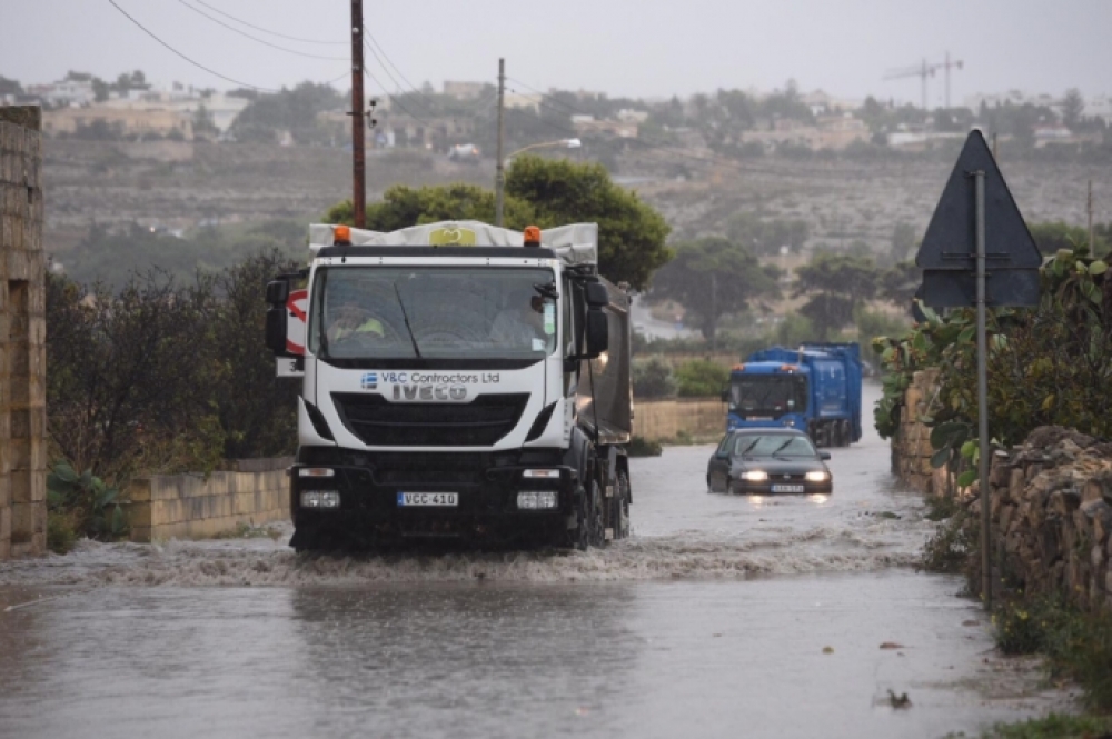
Registering 413.2 mm of rain, last Autumn was the wettest on record since 1999, when 473.1 mm of precipitation was measured.
Based on the 1981 – 2020 climate norm, the Maltese islands have already received 83% of the total rainfall expected during the precipitation year, which starts in September and ends in August.
Less than a third (18.4mm) of the rainfall quota for the month of September, however this was followed by a much wetter-than-average October and November, with 246.2mm and 148.6mm of rainfall, respectively.
Throughout the season, 17 thunderstorms were reported, with the most severe and widespread ones hitting the islands exactly one month apart, on October 25 and November 25.
These came after the development of areas of low pressure to the south of Malta.
The MET Office’s weather station in Ħal Luqa measured 51.6mm on October 25 and 70.4mm on November 25.
On November 29, the season’s maximum gust of 52 knots blowing from a west by south direction was recorded. This was much more violent than September’s and October’s maximum gusts of 26 knots and 38 knots, respectively.
The mean air temperature in November was 0.6°C higher than the norm of 17.6°C. the weather turned colder, with the air temperature eventually dropping to a crisp low of 9.9°C on the last day of the season.
The highest air temperature for the meteorological autumn of 34°C, on the other hand, was reached in September, which was also warmer than expected.

Karl Azzopardi is Online Editor and an IGM press awards (Human Stories) winner of 2019